Geolocate

Wespin topographic map

Click on the map to display elevation.

About this map

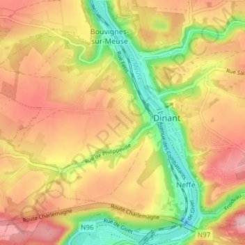
Name: Wespin topographic map, elevation, terrain.

Location: Wespin, Neffe, Dinant, Namur, Wallonia, 5500, Belgium (50.23845 4.88182 50.27845 4.92182)

Average elevation: 584 ft

Minimum elevation: 246 ft

Maximum elevation: 863 ft

Gear up for your next adventure:

📶Satellite Messenger - Communication device off‑grid
🏔️Mountain Trail Maps - High‑detail maps for popular peaks
🎒Day Hiking Backpack - Lightweight backpack perfect for day trips and outdoor adventures
🪓Survival Multi‑Tool - Versatile tool for camp and trail tasks
🧭Map Reading Tools - Tools and kits for map navigation

As an Amazon Associate, this site earns from qualifying purchases at no extra cost to you.