
秀里 topographic map
Interactive map
Click on the map to display elevation.
About this map
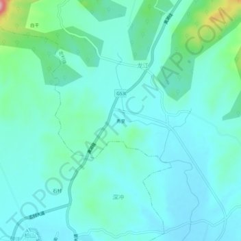
Name: 秀里 topographic map, elevation, terrain.
Location: 秀里, 宏村镇, 黟县, 黄山市, 安徽省, 中国 (29.93426 117.92816 29.97426 117.96816)
Average elevation: 755 ft
Minimum elevation: 650 ft
Maximum elevation: 1,263 ft
Other topographic maps
Click on a map to view its topography, its elevation and its terrain.