
Caleao topographic map
Interactive map
Click on the map to display elevation.
About this map
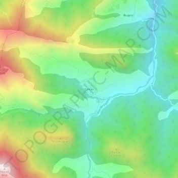
Name: Caleao topographic map, elevation, terrain.
Location: Caleao, Caso, Asturias, España (43.13531 -5.43251 43.17531 -5.39251)
Average elevation: 2,966 ft
Minimum elevation: 1,772 ft
Maximum elevation: 5,200 ft
Other topographic maps
Click on a map to view its topography, its elevation and its terrain.