
Coles Creek topographic map
Interactive map
Click on the map to display elevation.
About this map
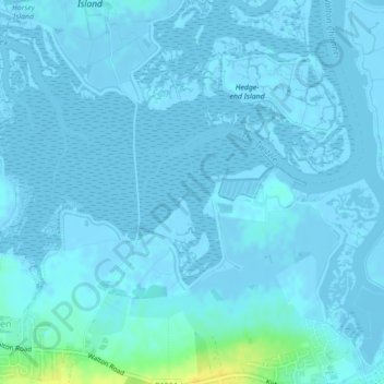
Name: Coles Creek topographic map, elevation, terrain.
Average elevation: 7 ft
Minimum elevation: -10 ft
Maximum elevation: 69 ft
Other topographic maps
Click on a map to view its topography, its elevation and its terrain.
St. Osyth
United Kingdom > England > Tendring
St. Osyth, Tendring, Essex, England, United Kingdom
Average elevation: 39 ft
Little Clacton
United Kingdom > England > Tendring
Little Clacton, Tendring, Essex, East of England, England, United Kingdom
Average elevation: 59 ft
Pincushion Island
United Kingdom > England > Tendring
Pincushion Island, Tendring, Essex, East of England, England, United Kingdom
Average elevation: 20 ft