
Arneburg topographic map
Interactive map
Click on the map to display elevation.
About this map
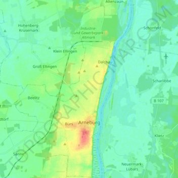
Name: Arneburg topographic map, elevation, terrain.
Location: Arneburg, Arneburg-Goldbeck, Stendal, Saxony-Anhalt, Germany (52.64363 11.93478 52.74182 12.04188)
Average elevation: 118 ft
Minimum elevation: 75 ft
Maximum elevation: 249 ft