
Relizane topographic map
Interactive map
Click on the map to display elevation.
About this map
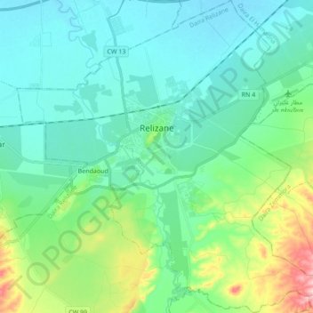
Name: Relizane topographic map, elevation, terrain.
Location: Relizane, daïra Relizane, Relizane, Algérie (35.65608 0.47790 35.79489 0.64835)
Average elevation: 302 ft
Minimum elevation: 161 ft
Maximum elevation: 820 ft
Other topographic maps
Click on a map to view its topography, its elevation and its terrain.