
Gunung Arjuna topographic map
Interactive map
Click on the map to display elevation.
About this map
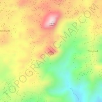
Name: Gunung Arjuna topographic map, elevation, terrain.
Location: Gunung Arjuna, Kebumen, Central Java, Indonesia (-7.71977 109.44551 -7.71967 109.44561)
Average elevation: 925 ft
Minimum elevation: 285 ft
Maximum elevation: 1,486 ft