
Sorinnes topographic map
Interactive map
Click on the map to display elevation.
About this map
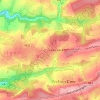
Name: Sorinnes topographic map, elevation, terrain.
Location: Sorinnes, Dinant, Namen, Wallonië, 5503, België (50.23973 4.96106 50.27973 5.00106)
Average elevation: 804 ft
Minimum elevation: 522 ft
Maximum elevation: 974 ft