
Parc hay El laymoune topographic map
Interactive map
Click on the map to display elevation.
About this map
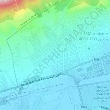
Name: Parc hay El laymoune topographic map, elevation, terrain.
Average elevation: 1,414 ft
Minimum elevation: 1,240 ft
Maximum elevation: 2,411 ft
Other topographic maps
Click on a map to view its topography, its elevation and its terrain.
Ouad Zitoun
Maroc > Pachalik du Fes > Fès
Ouad Zitoun, Sidi Ahmed Chaoui, Fès-Médina, arrondissement de Fès-Médina, Fès, Pachalik du Fes, Préfecture de Fès, Fès-Meknès, 30110, Maroc
Average elevation: 1,161 ft
Fès
Maroc > Pachalik du Fes > Fès
Fès, Pachalik du Fes, Préfecture de Fès, Fès-Meknès, Maroc
Average elevation: 1,417 ft