
Sulzberg topographic map
Interactive map
Click on the map to display elevation.
About this map
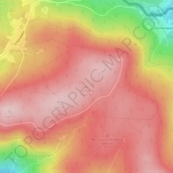
Name: Sulzberg topographic map, elevation, terrain.
Location: Sulzberg, Ulrichsberg, Bezirk Rohrbach, 4161, Österreich (48.69863 13.96370 48.69873 13.96380)
Average elevation: 3,146 ft
Minimum elevation: 2,556 ft
Maximum elevation: 3,406 ft
Other topographic maps
Click on a map to view its topography, its elevation and its terrain.
Bärenstein
Österreich > Bezirk Rohrbach > Ulrichsberg
Bärenstein, Ulrichsberg, Bezirk Rohrbach, 4161, Österreich
Average elevation: 3,048 ft