
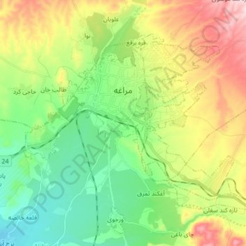
Maragheh topographic map
Interactive map
Click on the map to display elevation.
About this map
Name: Maragheh topographic map, elevation, terrain.
Average elevation: 4,918 ft
Minimum elevation: 4,360 ft
Maximum elevation: 5,909 ft
Other topographic maps
Click on a map to view its topography, its elevation and its terrain.
Maragheh
Iran > East Azerbaijan Province > Maragheh County > دهستان قره ناز > Maragheh
Maragheh, دهستان قره ناز, بخش مرکزی, Maragheh County, East Azerbaijan Province, 55146, Iran
Average elevation: 4,931 ft