
Penelakut Island topographic map
Interactive map
Click on the map to display elevation.
About this map
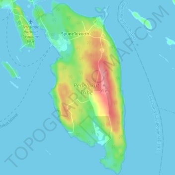
Name: Penelakut Island topographic map, elevation, terrain.
Average elevation: 43 ft
Minimum elevation: 0 ft
Maximum elevation: 302 ft
Other topographic maps
Click on a map to view its topography, its elevation and its terrain.
Valdes Island
Canada > Colombie-Britannique > Area G (Saltair / Gulf Islands)
Valdes Island, Area G (Saltair / Gulf Islands), Cowichan Valley Regional District, Colombie-Britannique, Canada
Average elevation: 36 ft
Thetis Island
Canada > Colombie-Britannique > Area G (Saltair / Gulf Islands)
Thetis Island, Area G (Saltair / Gulf Islands), Cowichan Valley Regional District, Colombie-Britannique, V0R 2Y0, Canada
Average elevation: 52 ft