
Parwari topographic map
Interactive map
Click on the map to display elevation.
About this map
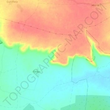
Name: Parwari topographic map, elevation, terrain.
Location: Parwari, Jawad Tehsil, Neemuch District, Madhya Pradesh, India (24.64099 75.08143 24.68265 75.12974)
Average elevation: 1,686 ft
Minimum elevation: 1,585 ft
Maximum elevation: 1,785 ft
Other topographic maps
Click on a map to view its topography, its elevation and its terrain.
Jawad
India > Madhya Pradesh > Jawad Tehsil > Jawad
Jawad, Jawad Tehsil, Neemuch District, Madhya Pradesh, 458330, India
Average elevation: 1,512 ft
Dhamaniya
India > Madhya Pradesh > Jawad Tehsil > Dhamaniya
Dhamaniya, Jawad Tehsil, Neemuch, Madhya Pradesh, India
Average elevation: 1,594 ft