
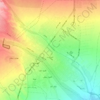
Jiroft topographic map
Interactive map
Click on the map to display elevation.
About this map
Name: Jiroft topographic map, elevation, terrain.
Average elevation: 2,280 ft
Minimum elevation: 2,083 ft
Maximum elevation: 2,523 ft
Other topographic maps
Click on a map to view its topography, its elevation and its terrain.
Darb-e Behesht
Iran > Kerman Province > Jiroft County > دهستان ساردوئیه
Darb-e Behesht, دهستان ساردوئیه, بخش ساردوئیه, Jiroft County, Kerman Province, Iran
Average elevation: 8,845 ft
Noorabad
Iran > Kerman Province > Jiroft County
Noorabad, بخش اسماعیلی, Jiroft County, Kerman Province, Iran
Average elevation: 1,870 ft
Jiroft
Iran > Kerman Province > Jiroft County > Jiroft
Jiroft, بخش مرکزی شهرستان جیرفت, Jiroft County, Kerman Province, 03443, Iran
Average elevation: 2,940 ft