
As Rodrigas topographic map
Interactive map
Click on the map to display elevation.
About this map
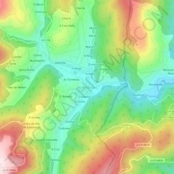
Name: As Rodrigas topographic map, elevation, terrain.
Location: As Rodrigas, Riotorto, Meira, Galicia, 27744, España (43.32183 -7.28144 43.36183 -7.24144)
Average elevation: 1,060 ft
Minimum elevation: 427 ft
Maximum elevation: 1,998 ft