Geolocate

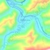
Majestic topographic map

Click on the map to display elevation.

About this map

Name: Majestic topographic map, elevation, terrain.

Location: Majestic, Pike County, Kentucky, 41547, United States (37.51400 -82.11985 37.55400 -82.07985)

Average elevation: 1,309 ft

Minimum elevation: 702 ft

Maximum elevation: 2,051 ft

Pike County trails, hiking, mountain biking, running and outdoor activities

Other topographic maps

Click on a map to view its topography, its elevation and its terrain.
Pikeville

United States > Kentucky > Pike County

Average elevation: 1,109 ft

Elkhorn City

United States > Kentucky > Pike County

Average elevation: 1,194 ft

Crow Hollow

United States > Kentucky > Pike County > Douglas

Average elevation: 1,142 ft

Gear up for your next adventure:

📚Navigation Handbooks - Master the art of reading topographic maps and using a compass
🧺Microfiber Travel Towels - Compact and fast-drying towels for trail use
🛡️Bear Spray Outdoor - Protection in bear country hikes
🪶LED Camping Lantern - Bright lantern for camp lighting
🎒Hydration Pack - Hands‑free water reservoir for long hikes

As an Amazon Associate, this site earns from qualifying purchases at no extra cost to you.