Geolocate

Gellik topographic map

Click on the map to display elevation.

About this map

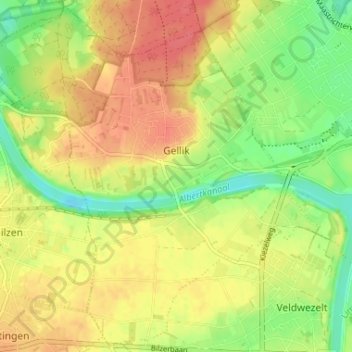
Name: Gellik topographic map, elevation, terrain.

Location: Gellik, Lanaken, Tongeren, Limburg, Flanders, Belgium (50.86115 5.57053 50.90076 5.63569)

Average elevation: 262 ft

Minimum elevation: 164 ft

Maximum elevation: 344 ft

Gear up for your next adventure:

📷Action Cameras - Rugged cameras to document your journeys across rugged terrain
🥇GPS Hiking Watch - Multi‑sport GPS watch with navigation and trail tracking
🧣Merino Neck Gaiters - Multi-functional headwear for wind and sun protection
🔥Fast-Boil Camping Stoves - Efficient cooking systems for quick trail meals
🧢Outdoor Hiking Hat - Sun protection hat for outdoor explorers

As an Amazon Associate, this site earns from qualifying purchases at no extra cost to you.