Town of Wethersfield topographic map
Interactive map
Click on the map to display elevation.
About this map
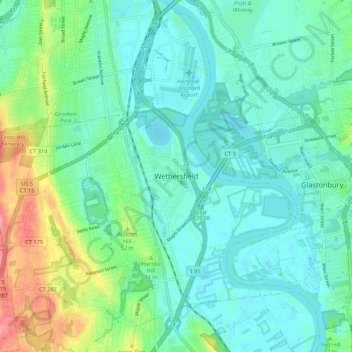
Name: Town of Wethersfield topographic map, elevation, terrain.
Average elevation: 72 ft
Minimum elevation: -3 ft
Maximum elevation: 302 ft

Click on the map to display elevation.
Name: Town of Wethersfield topographic map, elevation, terrain.
Average elevation: 72 ft
Minimum elevation: -3 ft
Maximum elevation: 302 ft