
Pitești topographic map
Interactive map
Click on the map to display elevation.
About this map
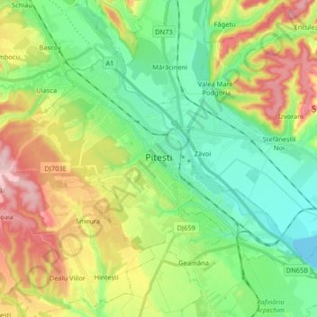
Name: Pitești topographic map, elevation, terrain.
Location: Pitești, Argeș, Romania (44.81748 24.78039 44.89583 24.94267)
Average elevation: 1,030 ft
Minimum elevation: 797 ft
Maximum elevation: 1,450 ft