
Gamlitz topographic map
Interactive map
Click on the map to display elevation.
About this map
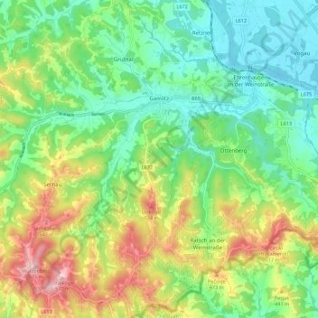
Name: Gamlitz topographic map, elevation, terrain.
Location: Gamlitz, Leibnitz, Styria, 8462, Austria (46.66927 15.47865 46.74448 15.57341)
Average elevation: 1,184 ft
Minimum elevation: 817 ft
Maximum elevation: 1,873 ft