
Harzgerode topographic map
Interactive map
Click on the map to display elevation.
About this map
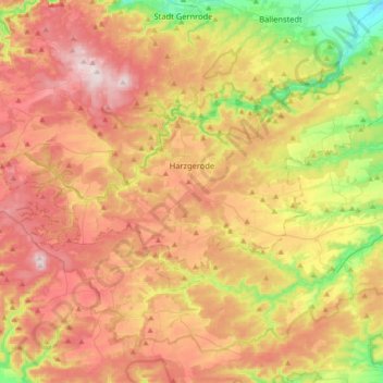
Name: Harzgerode topographic map, elevation, terrain.
Location: Harzgerode, Landkreis Harz, Saxony-Anhalt, Germany (51.56605 10.89706 51.68016 11.25252)
Average elevation: 1,240 ft
Minimum elevation: 522 ft
Maximum elevation: 1,926 ft