
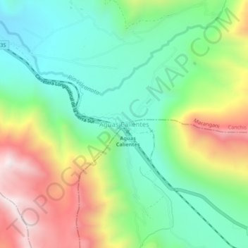
Aguas Calientes topographic map
Interactive map
Click on the map to display elevation.
About this map
Name: Aguas Calientes topographic map, elevation, terrain.
Location: Aguas Calientes, Canchis, Cuzco, Perú (-14.47041 -71.09355 -14.43041 -71.05355)
Average elevation: 14,006 ft
Minimum elevation: 12,884 ft
Maximum elevation: 15,955 ft