
La Ermita topographic map
Interactive map
Click on the map to display elevation.
About this map
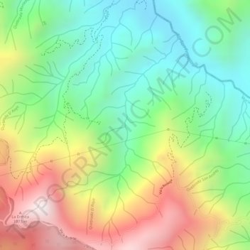
Name: La Ermita topographic map, elevation, terrain.
Location: La Ermita, Marsella, Risaralda, Colombia (4.89478 -75.71855 4.91442 -75.70165)
Average elevation: 5,272 ft
Minimum elevation: 4,245 ft
Maximum elevation: 6,670 ft
Other topographic maps
Click on a map to view its topography, its elevation and its terrain.
La Castellana
Colombia > Risaralda > El Jardín
La Castellana, El Jardín, Perimetro Urbano Pereira, Pereira, Risaralda, Colombia
Average elevation: 4,347 ft