
Thank you for supporting this site ❤️
Make a donation
Make a donation
Gear up for your next adventure:
As an Amazon Associate, this site earns from qualifying purchases at no extra cost to you.
Kayonza topographic map
Click on the map to display elevation.
Thank you for supporting this site ❤️
Make a donation
Make a donation
Gear up for your next adventure:
As an Amazon Associate, this site earns from qualifying purchases at no extra cost to you.
About this map
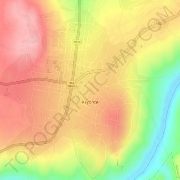
Name: Kayonza topographic map, elevation, terrain.
Location: Kayonza, Mukarange, Kayonza District, Eastern Province, Rwanda (-1.91745 30.49570 -1.88868 30.52004)
Average elevation: 5,141 ft
Minimum elevation: 4,813 ft
Maximum elevation: 5,335 ft
Thank you for supporting this site ❤️
Make a donation
Make a donation
Gear up for your next adventure:
As an Amazon Associate, this site earns from qualifying purchases at no extra cost to you.