Geolocate

Mancora topographic map

Click on the map to display elevation.

About this map

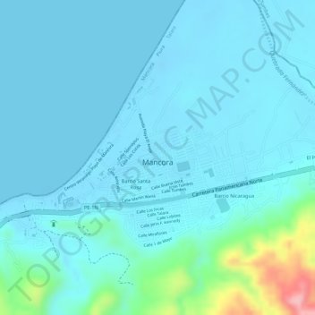
Name: Mancora topographic map, elevation, terrain.

Location: Mancora, Máncora, Province of Talara, Piura, Peru (-4.11060 -81.06432 -4.09472 -81.04087)

Average elevation: 72 ft

Minimum elevation: -36 ft

Maximum elevation: 509 ft

Gear up for your next adventure:

🪶Camping Sleeping Pad - Comfortable sleeping pad for backpacking
🎒Gear Packing Cubes - Organize your backpack efficiently
Backpacking Tent - Lightweight and durable tent for multi‑day hikes
🎁Geography Themed Gifts - Unique gift ideas for map lovers and geography enthusiasts
🧺Microfiber Travel Towels - Compact and fast-drying towels for trail use

As an Amazon Associate, this site earns from qualifying purchases at no extra cost to you.