Geolocate

Cadaclan topographic map

Click on the map to display elevation.

About this map

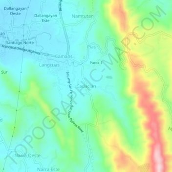
Name: Cadaclan topographic map, elevation, terrain.

Location: Cadaclan, San Fernando, La Union, Ilocos Region, Philippines (16.58639 120.33308 16.62639 120.37308)

Average elevation: 315 ft

Minimum elevation: 26 ft

Maximum elevation: 1,070 ft

Gear up for your next adventure:

🏔️Mountain Trail Maps - High‑detail maps for popular peaks
🎒Outdoor Daypacks - Lightweight backpacks designed for carrying maps and essential gear
📌Outdoor GPS Map App - Apps and devices for digital topographic navigation
🧯Portable Fire Pit - Compact fire pit for camping spots
🧤Hiking Gloves - Protective gloves for rugged trails

As an Amazon Associate, this site earns from qualifying purchases at no extra cost to you.