
Rhosmeirch topographic map
Interactive map
Click on the map to display elevation.
About this map
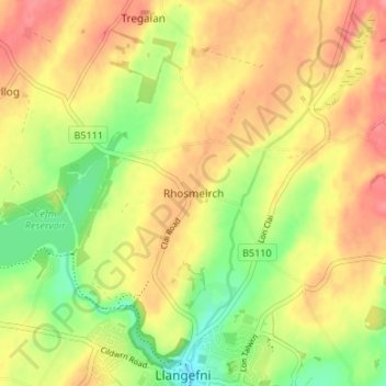
Name: Rhosmeirch topographic map, elevation, terrain.
Location: Rhosmeirch, Isle of Anglesey, Wales, LL77 7NJ, United Kingdom (53.25492 -4.32962 53.29492 -4.28962)
Average elevation: 177 ft
Minimum elevation: 36 ft
Maximum elevation: 289 ft