
Longmatan District topographic map
Interactive map
Click on the map to display elevation.
About this map
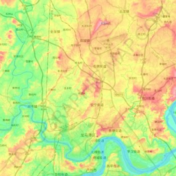
Name: Longmatan District topographic map, elevation, terrain.
Location: Longmatan District, Luzhou City, Sichuan, PRC (28.87149 105.32507 29.07068 105.56315)
Average elevation: 991 ft
Minimum elevation: 682 ft
Maximum elevation: 1,381 ft
Other topographic maps
Click on a map to view its topography, its elevation and its terrain.
Mount Siguniang
Mount Siguniang, Potou, Li County, Ngawa Tibetan and Qiang Autonomous Prefecture, Sichuan, PRC
Average elevation: 15,978 ft
Hanshui River
Hanshui River, Dachuan District, Dazhou City, Sichuan, PRC
Average elevation: 1,388 ft
Jialing River
Jialing River, Gaoping District, Nanchong City, Sichuan, 400000, PRC
Average elevation: 1,693 ft