
Woolnorth topographic map
Interactive map
Click on the map to display elevation.
About this map
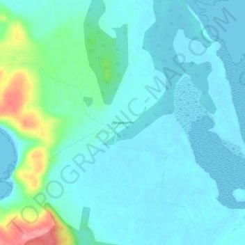
Name: Woolnorth topographic map, elevation, terrain.
Location: Woolnorth, Tasmania, 7330, Australia (-40.70349 144.70035 -40.66349 144.74035)
Average elevation: 56 ft
Minimum elevation: -7 ft
Maximum elevation: 315 ft
Other topographic maps
Click on a map to view its topography, its elevation and its terrain.