
Khorram abad topographic map
Interactive map
Click on the map to display elevation.
About this map
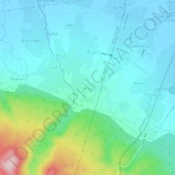
Name: Khorram abad topographic map, elevation, terrain.
Average elevation: 197 ft
Minimum elevation: -39 ft
Maximum elevation: 974 ft
Other topographic maps
Click on a map to view its topography, its elevation and its terrain.
بنجکول سفلی
Iran > Mazandaran Province > Nowshahr County > دهستان کالج
بنجکول سفلی, دهستان کالج, بخش مرکزی شهرستان نوشهر, Nowshahr County, Mazandaran Province, Iran
Average elevation: -36 ft