
Lundar topographic map
Interactive map
Click on the map to display elevation.
About this map
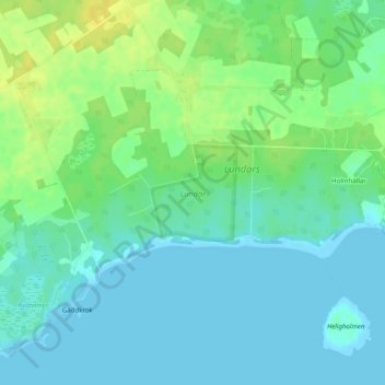
Name: Lundar topographic map, elevation, terrain.
Average elevation: 26 ft
Minimum elevation: -3 ft
Maximum elevation: 66 ft
Other topographic maps
Click on a map to view its topography, its elevation and its terrain.
Hemse
Hemse, Gotland Municipality, Gotland County, 620 12, Sweden
Average elevation: 72 ft