
Sotres topographic map
Interactive map
Click on the map to display elevation.
About this map
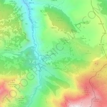
Name: Sotres topographic map, elevation, terrain.
Location: Sotres, Cabrales, Asturië, Spanje (43.21308 -4.76922 43.25308 -4.72922)
Average elevation: 4,058 ft
Minimum elevation: 2,362 ft
Maximum elevation: 6,719 ft
Other topographic maps
Click on a map to view its topography, its elevation and its terrain.
Majada de Ostón
Majada de Ostón, Cabrales, Asturië, 33555, Spanje
Average elevation: 3,625 ft
Bulnes de Arriba (El Castillo)
Bulnes de Arriba (El Castillo), Cabrales, Asturië, 33554, Spanje
Average elevation: 3,734 ft
Picos de Europa
Picos de Europa, Cabrales, Asturië, 33554, Spanje
Average elevation: 7,513 ft