
Tash-Komur topographic map
Interactive map
Click on the map to display elevation.
About this map
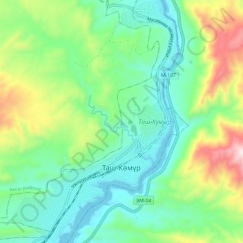
Name: Tash-Komur topographic map, elevation, terrain.
Location: Tash-Komur, Jalal-Abad Region, 03745, Kyrgyzstan (41.32648 72.18356 41.38720 72.23914)
Average elevation: 2,474 ft
Minimum elevation: 1,854 ft
Maximum elevation: 3,967 ft