
南町2 topographic map
Interactive map
Click on the map to display elevation.
About this map
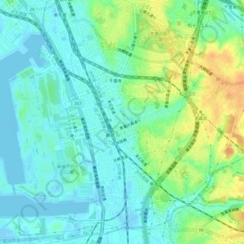
Name: 南町2 topographic map, elevation, terrain.
Location: 南町2, Chuo, Chiba, Chiba Prefecture, 260-0844, Japan (35.56253 140.11351 35.60253 140.15351)
Average elevation: 36 ft
Minimum elevation: -23 ft
Maximum elevation: 105 ft