
汉阴县 topographic map
Interactive map
Click on the map to display elevation.
About this map
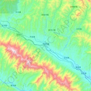
Name: 汉阴县 topographic map, elevation, terrain.
Location: 汉阴县, 安康市, 陕西省, 725100, 中国 (32.72563 108.34314 33.04563 108.66314)
Average elevation: 2,411 ft
Minimum elevation: 968 ft
Maximum elevation: 6,893 ft
Other topographic maps
Click on a map to view its topography, its elevation and its terrain.