
Heesakker topographic map
Interactive map
Click on the map to display elevation.
About this map
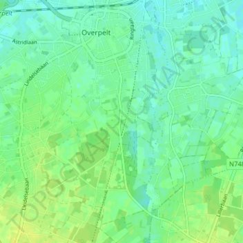
Name: Heesakker topographic map, elevation, terrain.
Location: Heesakker, Overpelt, Pelt, Limburg, Vlaanderen, 3900, België (51.17663 5.40965 51.21663 5.44965)
Average elevation: 157 ft
Minimum elevation: 131 ft
Maximum elevation: 190 ft