
Olne topographic map
Interactive map
Click on the map to display elevation.
About this map
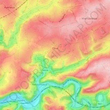
Name: Olne topographic map, elevation, terrain.
Location: Olne, Liège, Wallonia, 4877, Belgium (50.56360 5.69305 50.61040 5.77195)
Average elevation: 686 ft
Minimum elevation: 308 ft
Maximum elevation: 935 ft