
Municipio 2 topographic map
Interactive map
Click on the map to display elevation.
About this map
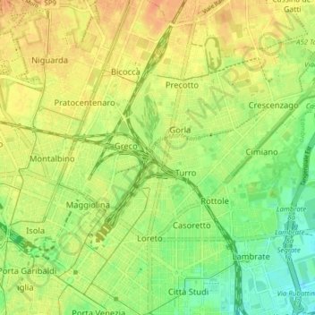
Name: Municipio 2 topographic map, elevation, terrain.
Location: Municipio 2, Milan, Lombardy, Italy (45.47654 9.19142 45.52372 9.26868)
Average elevation: 433 ft
Minimum elevation: 371 ft
Maximum elevation: 479 ft
Other topographic maps
Click on a map to view its topography, its elevation and its terrain.
Ronchetto delle Rane
Italy > Lombardy > Milan > Ronchetto delle Rane
Ronchetto delle Rane, Milan, Lombardy, 20142, Italy
Average elevation: 344 ft