
Huaca San Miguel topographic map
Interactive map
Click on the map to display elevation.
About this map
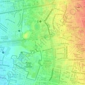
Name: Huaca San Miguel topographic map, elevation, terrain.
Average elevation: 236 ft
Minimum elevation: 148 ft
Maximum elevation: 325 ft
Other topographic maps
Click on a map to view its topography, its elevation and its terrain.
Leyenda
Perú > Lima > San Miguel
Leyenda, Virgen de Fatima, San Miguel, Lima, Lima Metropolitana, Lima, Perú
Average elevation: 177 ft
Parque Media Luna
Perú > Lima > San Miguel
Parque Media Luna, San Miguel, Lima, Perú
Average elevation: 115 ft
Virgen de Fatima
Perú > Lima > San Miguel
Virgen de Fatima, San Miguel, Lima, Perú
Average elevation: 135 ft
Parque Ciudades Hermanas
Perú > Lima > San Miguel
Parque Ciudades Hermanas, Virgen de Fatima, San Miguel, Lima, Perú
Average elevation: 167 ft