
Thank you for supporting this site ❤️
Make a donation
Make a donation
Gear up for your next adventure:
As an Amazon Associate, this site earns from qualifying purchases at no extra cost to you.
Misilmeri topographic map
Click on the map to display elevation.
Thank you for supporting this site ❤️
Make a donation
Make a donation
Gear up for your next adventure:
As an Amazon Associate, this site earns from qualifying purchases at no extra cost to you.
About this map
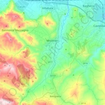
Name: Misilmeri topographic map, elevation, terrain.
Location: Misilmeri, Palermo, Sicily, 90036, Italy (37.95364 13.37402 38.08651 13.49026)
Average elevation: 1,093 ft
Minimum elevation: 56 ft
Maximum elevation: 3,179 ft
Thank you for supporting this site ❤️
Make a donation
Make a donation
Gear up for your next adventure:
As an Amazon Associate, this site earns from qualifying purchases at no extra cost to you.