
Gignod topographic map
Interactive map
Click on the map to display elevation.
About this map
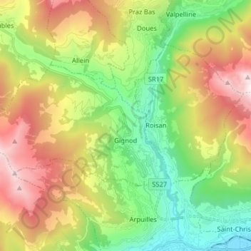
Name: Gignod topographic map, elevation, terrain.
Location: Gignod, Valle d'Aosta, Italia (45.76279 7.18922 45.80639 7.31802)
Average elevation: 4,610 ft
Minimum elevation: 1,795 ft
Maximum elevation: 8,862 ft