
Bouvignes-sur-Meuse topographic map
Interactive map
Click on the map to display elevation.
About this map
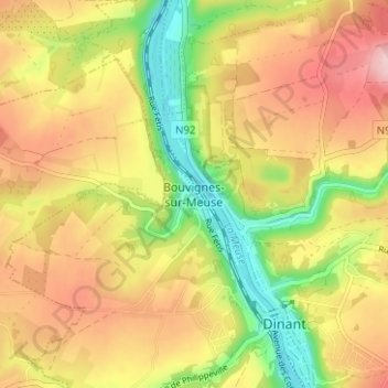
Name: Bouvignes-sur-Meuse topographic map, elevation, terrain.
Average elevation: 600 ft
Minimum elevation: 272 ft
Maximum elevation: 896 ft
Other topographic maps
Click on a map to view its topography, its elevation and its terrain.
Falmignoul
Belgique > Province de Namur > Dinant > Dinant
Falmignoul, Dinant, Province de Namur, Wallonie, Belgique
Average elevation: 699 ft
Furfooz
Belgique > Province de Namur > Dinant > Dinant
Furfooz, Dinant, Province de Namur, Wallonie, 5561, Belgique
Average elevation: 712 ft
Neffe
Belgique > Province de Namur > Dinant > Dinant
Neffe, Dinant, Province de Namur, Wallonie, 5500, Belgique
Average elevation: 604 ft