
Majalca topographic map
Interactive map
Click on the map to display elevation.
About this map
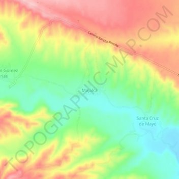
Name: Majalca topographic map, elevation, terrain.
Location: Majalca, Gran Morelos, Chihuahua, México (28.20453 -106.59076 28.24453 -106.55076)
Average elevation: 5,673 ft
Minimum elevation: 5,410 ft
Maximum elevation: 5,951 ft