
Llerana topographic map
Interactive map
Click on the map to display elevation.
About this map
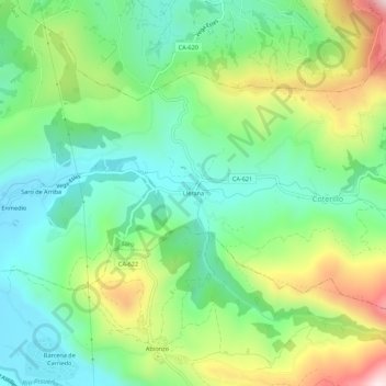
Name: Llerana topographic map, elevation, terrain.
Location: Llerana, Saro, Valles Pasiegos, Cantabria, 39639, España (43.24094 -3.82799 43.28094 -3.78799)
Average elevation: 1,050 ft
Minimum elevation: 492 ft
Maximum elevation: 2,142 ft