
Ferkane topographic map
Interactive map
Click on the map to display elevation.
About this map
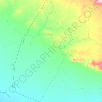
Name: Ferkane topographic map, elevation, terrain.
Location: Ferkane, Daïra Negrine, Tébessa, Algérie (34.29700 7.23017 34.68901 7.48662)
Average elevation: 666 ft
Minimum elevation: 144 ft
Maximum elevation: 2,700 ft