
Thank you for supporting this site ❤️
Make a donation
Make a donation
Gear up for your next adventure:
As an Amazon Associate, this site earns from qualifying purchases at no extra cost to you.
Bascaran topographic map
Click on the map to display elevation.
Thank you for supporting this site ❤️
Make a donation
Make a donation
Gear up for your next adventure:
As an Amazon Associate, this site earns from qualifying purchases at no extra cost to you.
About this map
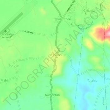
Name: Bascaran topographic map, elevation, terrain.
Location: Bascaran, Daraga, Albay, Bicol Region, 4501, Philippines (13.08485 123.67808 13.12485 123.71808)
Average elevation: 282 ft
Minimum elevation: 82 ft
Maximum elevation: 692 ft
Thank you for supporting this site ❤️
Make a donation
Make a donation
Gear up for your next adventure:
As an Amazon Associate, this site earns from qualifying purchases at no extra cost to you.