
倉敷市 topographic map
Interactive map
Click on the map to display elevation.
About this map
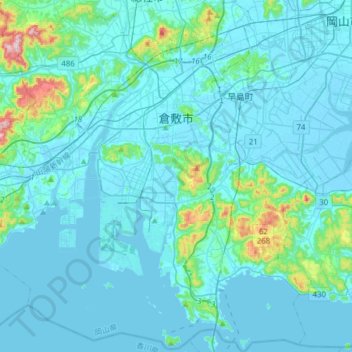
Name: 倉敷市 topographic map, elevation, terrain.
Location: 倉敷市, Prefectura de Okayama, Japón (34.41486 133.60243 34.66947 133.88551)
Average elevation: 118 ft
Minimum elevation: -16 ft
Maximum elevation: 1,273 ft