
Thank you for supporting this site ❤️
Make a donation
Make a donation
Gear up for your next adventure:
As an Amazon Associate, this site earns from qualifying purchases at no extra cost to you.
Fossato di Vico topographic map
Click on the map to display elevation.
Thank you for supporting this site ❤️
Make a donation
Make a donation
Gear up for your next adventure:
As an Amazon Associate, this site earns from qualifying purchases at no extra cost to you.
About this map
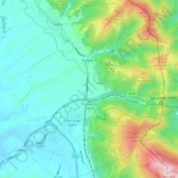
Name: Fossato di Vico topographic map, elevation, terrain.
Location: Fossato di Vico, Perugia, Umbria, 06022, Italy (43.26820 12.70266 43.34116 12.80244)
Average elevation: 2,014 ft
Minimum elevation: 1,207 ft
Maximum elevation: 4,429 ft
Thank you for supporting this site ❤️
Make a donation
Make a donation
Gear up for your next adventure:
As an Amazon Associate, this site earns from qualifying purchases at no extra cost to you.