Geolocate

Templeton topographic map

Click on the map to display elevation.

About this map

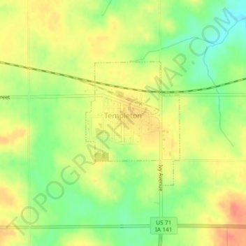
Name: Templeton topographic map, elevation, terrain.

Location: Templeton, Carroll County, Iowa, United States (41.91087 -94.94853 41.92445 -94.93466)

Average elevation: 1,424 ft

Minimum elevation: 1,335 ft

Maximum elevation: 1,493 ft

Carroll County trails, hiking, mountain biking, running and outdoor activities

Gear up for your next adventure:

📷Action Cameras - Rugged cameras to document your journeys across rugged terrain
🪶Trail Camera - Capture wildlife on your hikes
🔪Outdoor Multitools - Essential survival tools for gear repair and field use
💧Water Purification System - Clean water on the trail with reliable purifiers
📦Dry Bags Set - Waterproof storage for electronics and clothes

As an Amazon Associate, this site earns from qualifying purchases at no extra cost to you.