
Thank you for supporting this site ❤️
Make a donation
Make a donation
Gear up for your next adventure:
As an Amazon Associate, this site earns from qualifying purchases at no extra cost to you.
Lens-Saint-Remy topographic map
Click on the map to display elevation.
Thank you for supporting this site ❤️
Make a donation
Make a donation
Gear up for your next adventure:
As an Amazon Associate, this site earns from qualifying purchases at no extra cost to you.
About this map
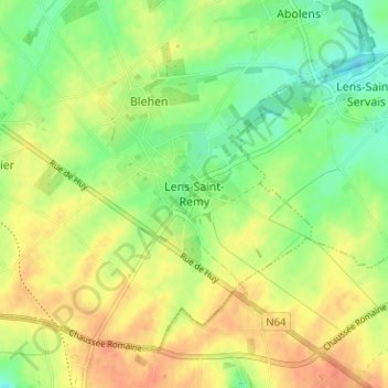
Name: Lens-Saint-Remy topographic map, elevation, terrain.
Location: Lens-Saint-Remy, Hannut, Waremme, Liège, Wallonia, 4280, Belgium (50.63340 5.11290 50.67340 5.15290)
Average elevation: 466 ft
Minimum elevation: 397 ft
Maximum elevation: 531 ft
Thank you for supporting this site ❤️
Make a donation
Make a donation
Gear up for your next adventure:
As an Amazon Associate, this site earns from qualifying purchases at no extra cost to you.